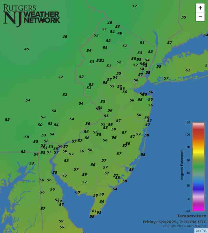
Latest temperatures across NJ appear in the above map. Click on the map or here, the Rutgers New Jersey Weather Network, for much more information.
Interested in becoming a volunteer weather observer? Click here to learn more about the CoCoRaHS Network!


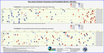
NJ Precipitation and Temperature departures
over the past 12 months

Plus First Half of 2026 Review
June 30, 2026
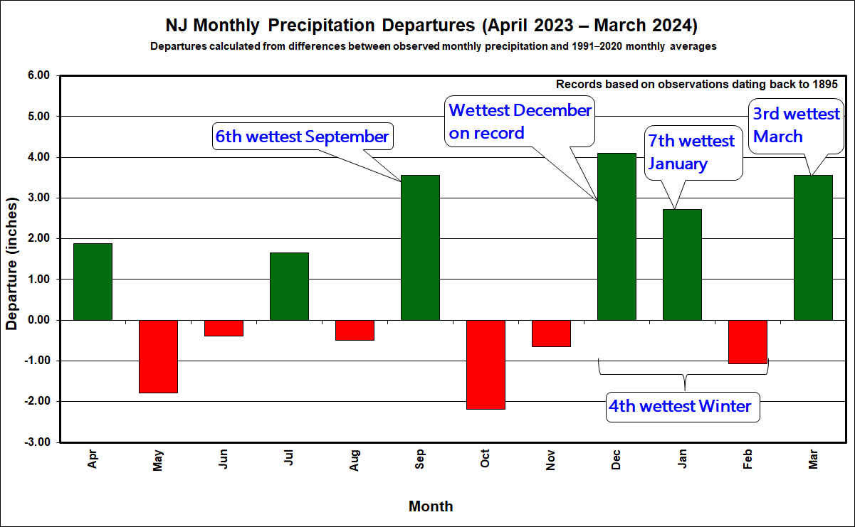
The title of this month’s report is appropriate for two very different reasons. First, it applies to Jersey-wide precipitation this month and over the first half of 2026 being well below normal. This condition has persisted over 23 of the past 26 months when compared to 1991–2020 normals.
The second reason for the title pertains to my 35-year run as New Jersey State Climatologist ending on June 30th as I retire from my academic career as a Rutgers professor and State Climatologist. I step down, proud of what our state climate office team has achieved and looking forward to future progress as Dr. John Krasting, a former Rutgers undergraduate and graduate student and, more recently, a respected scientist at NOAA’s Geophysical Fluid Dynamics Lab, grabs the baton. He will inherit a long-serving and dedicated staff. None more so than Mat Gerbush who has for years assisted with behind-the-scenes contributions to these monthly narratives. Expect great things from John, Mat, and others within the state climate office! Also, be sure to visit the newly updated state climate website that now combines information from our two former sites, one, a general state climate site, the other the Rutgers NJ Weather Network site. Having more of a Jersey focus than ever, check out new additions and upgrades to long-available maps, tables, and graphs. Explore NJ weather and climate data from over a century ago to the past five minutes!
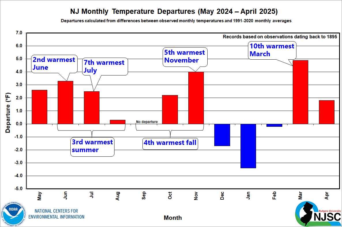
Back to a look at June 2026. The statewide average temperature of 71.9° is 1.6° above the 1991–2020 normal. This ties for the 9th warmest dating back to 1895. Nine of the 15 warmest Junes of the past 132 have occurred since 2005, with five of them within the past seven years.
Precipitation across New Jersey average 2.48” this June. This is 1.82” below normal and ranks as the 21st driest on record. The northern division averaged 3.04” (-1.57”, 37th driest), the southern division 2.18” (-1.96”, 21st driest), and the coast 1.63” (-2.22”, 7th driest).
More...
Past News Stories